Saturday, January 21, 2012

Wanaka to Queenstown, Our Last Day

As all good things do, our tour had come to its end. The last, and hardest, day from Wanaka to Queenstown, over the Crown Range was upon us. I was in no shape to ride, so I dressed in my civvies and gave David the camera. He was rewarded by being able to ride with the group (insofar as the group ever rides together) rather than being bogged down by me and my cold. I climbed into the van for another long day with Klaus and Julie (the non-riding spouse from Canada). 


First stop, coffee in Cardrona, a tiny town that scarcely existed before the gold rush, boomed then, shrank again to almost nothing, and then was saved by being close to two ski fields. The Cardrona hotel was quite a trip and a very pleasant place to sit and have a leisurely coffee.

There was an old shed with two wonderful dilapidated old trucks, a couple of bicycles, a tricycle, and other old junk among the old buildings surrounding the garden shown above. Full of boy toys, in other words.

The terrain was steadily and gradually uphill all day, but the last 3 km to the summit were reputed to be very tough, and a pretty stiff headwind had developed. At the morning briefing, the plan was that Klaus would stop the van at a chain fitting bay just before the hard climb and give a lift to anyone who wanted to avoid the climb. However, after coffee, Alex said that everyone had indicated that they planned to give the climb a go, so there was no need to stop there. Klaus did pull over until the first 3 or 4 people passed, but then he headed up to the top, figuring people might need warmer clothes from the van. The first several people came struggling up, indicating it had been a very tough climb indeed. Most of them had their outerwear with them. Julie kept saying that her husband Cor, the 76-year-old rancher from Alberta, didn't like headwinds, but Klaus didn't seem to think he needed to go back down to check. It was a very long wait. Eventually, Alex appeared, saying that Cor had had a flat, which they had repaired, but there was a long slit in the tire, so he'd need to swap wheels with Klaus' unused bike before the descent. He grabbed the floor pump, indicated that at this point there was no need for Klaus to go back down, and cycled back down to Cor. Next up was Steve, our Brit who had been the city manager of Blackpool until retirement. He was furious and really reamed Klaus out. "If you say you're going to be at the chain bay, then you need to be at the chain bay! When Cor had his puncture, Alex said we could get a new wheel at the chain bay, and you weren't there. There was enough space between the two groups of riders that you should have known something had happened," etc.  But he was right, Klaus does seem to have a great reluctance to retrace his route, and this is what caused the problem with Isabelle as well.

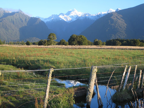
The descent was scary enough from the van, and I wondered what it must have been like on a bike. The headwind was blasting, the descent was steep and curvy, turning into sharp switchbacks below, and there were roadworks near the top. This road has only been sealed since 2000, and it seems to be very difficult for them to keep it sealed. The spot where there was one-way traffic control was nearly eaten away by the extreme weather conditions.

On the way down, there was a herd of reindeer (?) with huge racks. Among New Zealand's unusual products is deer velvet, considered an aphrodisiac in Asia, I believe.

Lunch was in Arrowtown, a cute, if touristy, town near the base of the mountain. We had heard about this town from a couple walking their disabled-aide dogs around Lake Matheson. They live there and said we just had to see it. The first group over the summit got a pretty good look at it. Those of us in the van were hurried through our lunches (once we got them) and back into the van, since Klaus wanted to take the van in for door repars in town. Plus, Steve had broken a tooth and needed a dentist, and Klaus had found him an appointment, but Steve had pedaled straight on through, so he had no details.

So we took the most direct route to Queenstown, but the cyclists took a more scenic route via the Shotover Road, with a great view of the jet boats from the Shotover Bridge.  I'll let David tell you about that part of the trip.

Our group went on towards Arthur's Point and descended to a crumbling old, one-lane bridge over the Shotover River, with a quick left and uphill after it. I'd seen people stopped nearby so I pulled off the road and went back for pictures of the view. There was a narrow edge with railing, and as I went out I was surprised to see a red boat blast up river under the bridge, seemingly barely missing the boulders and rock walls. It then spun a U-ie and careened back down river, passing under the bridge and spinning around again to dock at a mooring on a sandy spit. 

This was the Shotover Jet Boats attraction and we watched as several boats full of screaming passengers came and went, first disappearing down river then returning for the perilous trip under the bridge and past the sheer rocks. The jet boats are the invention of a New Zealand farmer who wanted a fast but minimal draft boat (they have no propellers) to navigate shallow waterways. With the addition of several hundred horsepower, you have an amusement park ride on the river which brings hundreds of people a day by bus from Queenstown and the area.

Another steep climb after the bridge brought us over the crest for a view of Queenstown, before the final descent to the hotel -- well, not quite, since the hotel was also up a hill. Bottom line: 1027 m of climbing over a 78 km day.

One interesting twist to the day was that as the van approached the Copthorne Hotel, there was a road detour that seemed to cut off all the entrances to the hotel, one of which was itself torn up. Klaus really needed to offload the baggage and find Steve for his dental appointment, so he was none too pleased. He followed the detour, however, and we found that we could get into the one open entrance after all. We were greeted with the news that there was currently no water at the hotel (hadn't been since 10:00) and they did not yet know when it would be turned back on! When the cyclists showed up, it was still off, but came on at about 5:30. Apparently, the water outage was entirely unrelated to the road works. One last dinner down in town, which I skipped, eating half a bowl of soup in the hotel restaurant.

The last official "day" of our Pedaltours was breakfast at the Copthorne. This is one of the odd things about Pedaltours. The day we met was a half-day, with orientation, handing out of jerseys and water bottles, and (for those who had rented them) bicycles. Then a short spin to try the bikes, and dinner. Two rest days in the middle, one of which served as a juncture between the two back-to-back tours that comprise the Southern Grand Tour, and this final breakfast at the Copthorne meant that our "16-day" tour involved 12 days of riding. The 16th day also served as a juncture to the last portion, which 5 of the participants were continuing on with. While we had lost three and gained three at the first juncture, they simply lost 5 of us and one guide (Alex) here. So there is some method to their madness, I guess. And I can't say the rest days weren't welcome. Both Punakaiki and Fox Glacier were good places to explore. Backroads, which was a day ahead of us after Punakaiki, had a rest day at the Wilderness Lodge, and their day hike included seeing a penguin! At this time of year, they are apparently molting and staying out of sight,

We had declined to pay Copthorne rates for our final non-tour two nights in Queenstown, so we had to find the Pounamu Apartments and get all our stuff there. Despite being cheaper than the Copthorne, they have a kitchenette, free laundry, and 100 MB free WiFi, compared to no kitchen, guest laundry done at a premium by hotel staff, and WiFi available only in the lounge, also at a much higher price. Pounamu turned out to be within easy walking distance, albeit not with luggage. We hired a taxi, checked in early at the new place, and I went back to bed while David walked back twice and rode our bikes here. The last two days have consisted of me mostly resting and David taking in the sights. No jaunts to the fiords around Milford Sound or rides up the gondola to hike the mountain are in the cards for this trip. Guess we'll have to come back!

Hacking and Blowing our way to Wanaka

 Once again, the weather changed -- I've never known such a changeable climate! The morning started out sunny, but before we were done with breakfast, we could see rain showers closer to the peaks. We were still not far from that dividing line between buckets of rain and very little. Alex, our guide, swore it never rains in Wanaka, our destination for the night, so we took heart. Plus it helped that the tailwind continued strong. Although I was now considerably sicker, I decided I'd give it a try. We set off down wind and down valley in a light drizzle. More great waterfalls, more great views made all the more spectacular by the clouds, and more gentle climbs which were becoming more and more difficult. 

Even with the considerable assist of the tailwind, each small rise left me gasping and wheezing. At least the rain had let up as we moved away from the ridge. By prearrangement, we met Alex at the base of "The Neck" a mound of rock formed by two glaciers running up against each other. The climb didn't look too bad, so I decided to risk it. And made it. Quite an interesting sight. To one side, Lake Wanaka, to the other Lake Hawea, and in between this little neck of land. 

Alex waited at the top, but I could see that it was payback time. No way was I going to all the hard work of climbing The Neck and not get the descent! So I arranged with him to meet me at the bottom of the one significant ascent for the day (not all that significant, but steeper than the rest of the day).  At every turn Lake Wanaka became more spectacular. These are not small lakes, and the wind was whipping them into a fury.

By the time Alex had loaded me and my bike up and driven the 3 km to the top, David had ridden up it. A  quick look around at the lookout (at the risk of blowing away -- I nearly lost my helmet and gloves by putting them on the ground as I put my pump back on) and off we blew again.  By now I was getting mighty hot, as I had bundled up in hopes of not making my cold any worse, so I stopped and stripped off several layers. At this point, David made the mistake of leaving me behind. So when we reached the earthen dam at the end of the lake, he failed to make the turn to coffee in Hawea. Perhaps he knew what he was doing. Crossing the dam in a roaring cross wind was extremely tricky. At least on the way there, we were on the upwind side of the road. On the way back, blowing sideways threatened to send you over a low guardrail and down the outflow of the dam. Once around the corner at the end of the dam, it was a short push into the teeth of the wind, and then there were some conveniently planted windbreak trees. Coffee was great, and David didn't get to share my lovely date scone. Serves him right.

From coffee, it was only about 14 km to Wanaka, but those were some of the hardest km I've ever ridden. Not difficult terrain and the tailwind persisted, but I had no wind myself. As I pulled into Wanaka, I could see it was beautiful and also that there was no way I was going to see any of it. The Te Wanaka Lodge was one of the most convoluted places I've ever seen. You had to go up and down stairs and around corners to each somewhat separate room block, but the container of earplugs in the bathroom suggested that the rooms were not as secluded as they appeared. I was really glad David was there to lead me to our room and carry my bag, as I was in no shape for any of this.

No sooner had we gotten in than the wind really began to blow in earnest, and it began to rain (so much for Alex's prediction). There was major triathlon event scheduled for the next 3 days, and we couldn't imagine how these poor people were going to stay upright on their bikes, much less swim in the whitecap tossed waves of the lake!

After a shower and a nap, I recovered sufficiently to go out to dinner with some of the Pedaltours group. The Cow pizza place was quite popular, and oddly decorated, with chamber pots and other large curiosities perched precariously on the rafters above the diners. We decided to eat outside. Good pizza, and the largest serving of garlic bread you've ever seen (an entire loaf of bread, slathered in herbs, garlic and butter or oil, and served with garlic impregnated butter). One loaf was sufficient for the entire table. A small pizza was easily sufficient for both David and me. One thing I haven't lacked on this trip has been sufficient food.

Back in the Lodge, the internet was only available in a common room, and it was not quite clear how to access it. Not that I really wanted to blog anyway. Off to bed, and a night of hacking and blowing. At least David had managed to secure some Mucus Relief with guaifenisin to help clear out my lungs. Too bad he didn't think of using the earplugs.

Friday, January 20, 2012

Lake Moeraki to Makarora

Leaving Lake Moeraki, we were treated to another glorious, sunny day. Maybe it really is summer here! After a short jaunt down the lake we began to have views of the coast again.

Soon we dropped down closer to the shore and rode along it for a while. This is Ship's Creek just around the point you can see above and a beautiful place, but loaded with sandflies. Fortunately, they seem to like David more than they like me, and I escaped with only a couple of bites. David had a dozen or more. This incomplete panorama was taken from a viewing tower. It was meant to include more of the beach to the left, but evidently, I didn't leave enough overlap.

After the daily coffee stop in Haast, we turned inland again and started climbing up the Haast River valley. Fortunately, we had a nice strong tailwind and the grade was quite gentle, as by now the wheezing I had developed on Fox Glacier had turned into a hacking bronchitis cough. I wasn't sure how far I could make it, but the tailwind was so good and the views so glorious, I figured I'd ride as far as I could and then accept a lift up the steep part to Haast Pass. Because of the recent rains, we saw numerous waterfalls roaring down the steep slopes, including this one, Roaring Billy Falls, where we ate the picnic lunches packed for us by the Wilderness Lodge. 

Getting to the falls required a 20-minute (round-trip) bush walk with its own interesting sights. This tree had a cavity large enough to stand in, presumably from a lightening strike.  As we were coming out, Isabelle (our French Pedaltours companion) was just going in. This will become significant a little later.

Thundercreek Falls marked the start of the steep climb, so I stopped there and waited for the van to be ready to drive me up. 

And while we were waiting, I got a chance to photograph one of the enormous dragonflies we had been seeing for days. This one must have fallen off a car grill, so he was dead enough to pose well....

We figured Isabelle couldn't be that far behind.... After well over an hour, I managed to persuade Klaus (our guide who was driving that day) that we should drive back along the route, in case she had had a flat or something (she is not a very experienced rider). Sure enough, just as he predicted, as he put the key in the ignition, she showed up. And, just as I had predicted, she had had a flat only 10 km from lunch. Since our "sweep" had ridden ahead with most of the rest of the troupe, and Klaus had failed to keep an eye on her, she had had no other choice than to learn to change a flat. And managed, although her frustration was fairly evident. She accepted a lift up the steep part just to avoid being so far from the group.

We only had to drive about 5 km to get past the steep bit (and the road works), and Klaus set us down with more gently rolling hills to come. The tailwind persisted, so we were happy. About 6 km later, we were at Haast Pass, elevation 654 m, and the boundary between the Westland, through which we'd been cycling for most of the tour, and Otago.

The most striking boundary, though, was between the rainforest, sandfly-infested, heavy rainfall western environment and the much drier one east of the alps. Nothing could be more clear than why we got all the rain on the western side. The mountains are tall enough and steep enough that they wring out the clouds before they can cross over.


That night, we stayed at the Makarora Tourist Center, a rather more rustic accommodation than we have experienced thus far. It looks to be an ex-youth camp, or something, with A-frame cabins that can each sleep about 6 people, and the bathrooms very much an afterthought. Each couple (or single person) had an entire cabin to themselves. David was given a rather abrupt introduction to how rustic it all was as he opened the door. This was on the threshold, dead as a doornail, evidently crushed when he tried to rush out the door as the cleaners left.

In the night, we could clearly hear the morepork owls calling for ham -- at least when I wasn't drowning them out by coughing. The extra beds -- and rooms -- came in handy, as David was able to sleep a bit farther from my germs and hacking.

No internet either, hence the late post.

Tuesday, January 17, 2012

Fox Glacier to Lake Moeraki

Today, the weather was glorious. After breakfast and loading up our luggage, we headed off down route 6 through beautiful alpine scenery with excellent views of the alps. Cold, but downhill and easy, with beautiful scenery.

At one point, we came suddenly out at the beach. It was rather hard to reconcile the snowy alps we'd just been looking at and the nice warm beach. Truly a land of contrasts.

The total ride was about 90 km with very little climbing and a fair bit of descending. Finally, it was payback time, especially with the weather. Coldest temps we saw were 46 in the morning, and highest were in the 70's in the afternoon.

Upon reaching our lodging, the Lake Moeraki Wilderness Lodge, we were given a choice of a number of self-guided walks, as well as two evening guided walks. We chose to wash clothes and nap before the guided walks. The first walk, before dinner, took us through one of the few never-logged floodplain rainforests left in New Zealand. There were several splendid examples of kahikatea trees, very slow growing, ancient trees that used to be widespread in New Zealand, but now have been reduced about 98% by being cleared to create farmland. Note the huge number of other species clinging to them, including the vine-like ratas (those red-flowered trees we've been seeing all over New Zealand). This kahikatea is probably between 800 and 1000 years old (and you're only seeing a very small section of it. Autostitch really does not do a good job of stitching together vertical panoramas, which isn't surprising, since the magnfication is so different as you go up).

The Maoris called these something like food basket trees (in Maori, of course) because they supported such a huge variety of life in addition to their own fruit, which the Maoris climbed 120 feet or more to harvest. They also set traps for wood pigeons (the ones with the frilly pantaloons we saw yesterday at Lake Matheson). These kahikateas are so slow growing that this little seedling, only about knee-high, is about 10 years old.

The other example of ancient tree was the rimu trees, also covered in rata vines. These are the other major canopy trees in the forest and, unlike the kahikateas, are highly prized for lumber.

And this is a rimu seedling. There was something really charming about getting to see both the elders and the youngest examples side by side. This little guy is really wonderful to stroke, and our guide says it's the most pampered rimu in New Zealand since he pats it every time he goes by.

The highlight of the walk was the eel feeding. When we had reached the rimu, our guide excused himself for a moment and slipped off with the bag he had been carrying. A few moments later he was back and gave us the explanation about the rimus. Then we made our way down to the riverside. It turns out that he had put some strips of raw meat into the river in a little place designed to allow the water to flow through but keep the meat there. The smell of the meat travels downstream, and pretty soon the eels start coming to find it. He said the Maoris used to bring their dead to the riverside to be cleaned. So they never eat the big eels, only the little ones.

Just now, starting at 10:30 p.m. (just getting dark enough), we went for a star and glow worm walk. About 5000 stars of the Milky Way are visible here, while only about 1500 are visible in the northern hemsphere. Finally, David got to see the Southern Cross. And, of course, familiar constellations like Orion are upside down. The glow worms are little larval worms that hang by little threads from clay banks (often in caves, but in this case just an old landslide at the edge of the road). They are sticky and glow to attract insects, which they eat. En masse they form dozens of twinkling Christmas tree lights among the foliage. After about 9 months in their larval form, they become little gnatty insects that live for three days, mate, lay their eggs on a bank and then die.

In addition to celestial and terrestrial stars, we saw several satellites, including the space station, pass overhead. And when we were quiet enough, we could hear the little morepork owls across the lake crying "more pork," "more pork."

Monday, January 16, 2012

Fox Glacier

Sunday morning dawned no better than the day before. The rain had thundered on the metal roof all night,so we were not too hopeful about the day's riding ahead. In fact, after breakfast, 5 of us (half of the group) rebelled and decided we'd ride in the van in hopes that it would clear up enough to ride later. Nearly 30 km into the ride, it did clear up and most of us were suckered into getting down the bikes, gearing up and getting ready to go. So it promptly started to rain again. Sigh. Well, we were committed now (or should have been, perhaps), so we soldiered on the 15 km or so to lunch in the town of Franz Joseph Glacier. Too much lunch for so little riding, and then we were off into yet another shower. We had cut out mostly flat riding, and the terrain after lunch was to be three good climbs. Oh, too much lunch. It kept warming up (jacket off) then raining again (jacket on), and then warming up, and then raining again. Oy.

Just as on the day out of Westport, our guide (Alex this time) claimed we were at the top of the second climb when it was really the top of the first. Do they really think we can't count? Is this their idea of encouragement? Can't they count? Well, they're nice guys, so we won't hold it against them.

The last climb was the shortest, but also the steepest, plus a couple of cattle guards (or cattle stops, as they call them). One more really good descent (only it was raining, get the picture?), and we rode into Fox Glacier and our hotel. More stripping off of wet clothes and carrying bikes through to the patio where they could drip off under the overhang. 

By dinnertime, however, things had cleared up, and we were rewarded by seeing the Southern Alps at last.

And, after dinner, by seeing some keas -- the large parrots native to the south island that are famous for chewing rubber. Like bike seats and handlebar tape. I went straight back to the hotel and covered my saddle with a Bike to Work Day musette.

Today was a rest day, so we took a half-day glacier walk (you're actually on the glacier for only about an hour, but it takes the rest of the time to gear up with boots and crampons, drive up there, and hike up to the glacier terminus, plus everything in reverse after. The glacier forms from the 30 to 60 meters (!) of snow that falls at the neve (the top, where the glacier forms). And it takes 50-60 years for what fell up there to reach the terminus. This is a view as we hiked up the moraine towards the terminus. The bluish water is glacial melt that's had time to settle. In this case, it's the melt from the carpark, which is on top of a large chunk of the glacier that broke off in about 1960 and then was covered by a rock fall, which insulated it from its normal melting rate. Every year, the carpark subsides about a meter and they have to repave it.

And hiked a bit further, crossing a stream that had been diverted a couple of days ago when the heavy rains (that we were riding in) caused a flash flood, bringing down a bunch of rock. 

When we had almost reached the terminus, we put on our insole crampons.

Just as we finsihed putting on our crampons, we heard a loud roar and turned around just in time to see the last bits off ice fall from where a chunk of the glacial face had broken off and crashed to the ground below (the clean-looking little pile of snow at the bottom of the face below).

Once on the ice, we were instructed to follow in a single line behind our guide and to keep back a little distance from his swinging ice axe (he was reforming the stairs cut in the ice in places where they had melted enough to become dangerous). Straying off from his path risks falling into a sinkhole or coming too close to an edge that is ready to break off.

Our guide, Dean, explained how glacial moulins got their name. Some Frenchman thought they looked like the fixed stone funnel part of a grain mill. Not sure I'd agree, but at least I'll be able to remember what they're called. They are basically a place where the glacial melt stops flowing on top of the ice and instead forms a sort of waterfall as it drops through the ice and flows inside or under the glacier. This is one end (the lower end)... 

And this is the other (upper) end of one.

And this was a really cool one that he had been watching develop for several days. It must be fun to come out onto the glacier often enough to see these changes happening.


This picture shows the path we climbed up and down to get on and off the face of the glacier. The two men are standing just to the left of it, and you can see that the drop-off to the right of it is getting kind of close to it. In a day or two, it will be too dangerous to walk there, so the guy farther to the left of the picture is starting to hack a new path.

After returning to town and doing our laundry, we rode out to Lake Matheson (about 5 km). This is supposed to be the iconic New Zealand picture, but you have to get there early in the morning when the lake is still and the clouds haven't formed from the warm air rising up the mountains. Still pretty darn gorgeous. There was another wonderful rainforest walk around the lake, and we took too many pictures, but it's getting late, and I need to go to bed.

We did see a couple of new birds. A number of fantails, but they moved too fast to let us take a picture. And a kereru, or New Zealand pigeon. Lovely white bloomers, I must say.

And, finally, dinner at the Lake Matheson Cafe. Decidedly a "posh nosh" as the reviews had promised, and you can't beat the view. As the evening wore on and the clouds cleared, Mt. Cook (on the right) and Mt. Tasman (on the left) came into view. This picture was taken not from the restaurant, but about 1/2 a km away as we rode home. 


Saturday, January 14, 2012

Hokitika to Te Taho (Whataroa)

After storming like crazy all night, the weather cleared somewhat this morning. In fact, the sun came out while we were eating breakfast! So we saddled up and headed out into a stiff cross wind off the ocean. Fortunately, we soon turned off onto a more sheltered country road. One stop was at a historical site at Rimu, a former mining town. Informational panels explained how the scene before us (see below) had been utterly transformed by hydraulic mining and dredging for gold.


That has been one of the paradoxes of New Zealand for us. Everywhere, you see rather brutal looking clear cuts that seem to be a routine part of New Zealand silviculture. Coffee was in the town of Ross, under which some NZ$7 million worth of gold was recently discovered. One of our guides says they're contemplating moving the entire town over onto the tailings from a previous mining venture so they can dig up the current town site to get the gold. What that will mean for the cafe where we had our coffee, I have no idea. It was a really interesting pastiche of strange old implements such as this sawing machine.


As we left Ross, we saw several ongoing mining operations, which seemed so incongruous in the otherwise stunning beach scenery.


And, although the Kiwis like to say that there are no poisonous critters in New Zealand, that doesn't count the dead ones deliberately poisoned in their ubiquitous attempts to control the non-native pests like possums (protected in Australia), stoats, rats, etc, that are devastating the native birds and plants.


One rather interesting place we visited today was the Bushman's Centre in Pukekura (population 2), full of possum and deer pelts, weird knicknacks, merino and possum woolen articles, and countless gags in dubious taste.


They even had a family of thar, a chamois-like mountain goat native to Nepal.


Shortly after that, I had my obligatory encounter with an abandoned cat (I seem to have one on most bike tours). As we crossed Evans Creek, I heard a plaintive cry from below and looked down to see a little kitten stranded mid-stream on a rock. After a while, I spotted a second one just making its way to shore. I could see no way the first kitten could reach shore, nor how I could reach it. 


 Deciding at last that I couldn't do anything immediately for it, I cycled on until I caught David, who had the phone. We called 111, the NZ equivalent of 911, and they connected me with the police somewhere. After some explanation of the problem (yes, I'm in a cycling tour of New Zealand -- they must get a lot of this), she promised to contact the local council to do something about it. Sure enough, when we reached out night's destination, there was a message from the SPCA saying they had gone looking for the kittens but not found them. I'll never know.....


After lunch (at km 76) in the town of Hari Hari, it started raining in earnest, and the temperature dropped into the low 50's. We had only 22 km to go, but there was the small matter of Mt. Hercule to get over. It turned out to be a relatively easy climb and a descent I would have loved if the pavement had been dry. As it was not, it was somewhat tricky descending thru about 25 tight turns with cars passing impatiently. At last, we reached Te Taho, a tiny little community with a sort of farm stay establishment that did not blink an eye at 8 soggy cyclists turning up and dripping all over their floors. A wonderful home-cooked meal, and so to bed.